
Geography· Prelims · GS-I
Beneath Your Feet: Inside the Earth's Interior, Minerals and Rocks
No one has seen deeper than a few kilometres, yet we know the Earth's layered anatomy in detail. Seismic waves, the rock record and mineral chemistry reveal the interior - and UPSC tests all of it.
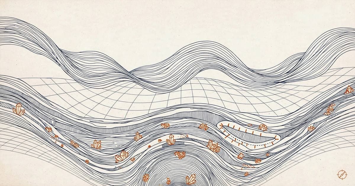
Nobody has ever seen deeper than about 12 kilometres into the Earth - the deepest drill hole barely scratches the surface. Yet geographers can describe the planet's interior layer by layer, name its minerals in order of hardness, and trace how every rock transforms into another. This article is your guided tour of that hidden anatomy.
How we see inside a planet we cannot visit
Since direct observation stops within a few kilometres, scientists triangulate the interior from indirect evidence. The most powerful probe is the study of seismic waves generated by earthquakes: how they speed up, slow down, bend or vanish reveals the density and state of each layer they cross. Imagine shaking a wrapped gift and working out what is inside from the feel of it - seismology works on the same principle, at planetary scale.
Other clues fill in the gaps: gravity anomalies hint at mass distribution, the magnetic field points to a metallic core, meteorites sample the solar system's original material, and volcanoes deliver actual magma from the upper mantle to the surface. The deepest scientific drilling has reached only 1,268 metres below the seafloor into the upper mantle - everything deeper is inference, but remarkably solid inference.
The three layers of the Earth
Think of the Earth as an onion of rock and metal, each layer with its own composition, density and behaviour. The contrasts between them - not the layers alone - drive everything from earthquakes to continents.
Crust - the brittle skin
- Outermost solid layer, brittle in nature; oceanic crust is about 5 km thick, continental crust about 30 km (up to ~70 km under the Himalayas).
- Two parts: Sial above (granitic, silica + alumina, forms continents) and Sima below (basaltic, silica + iron + magnesium, forms ocean floors).
- The Moho (Mohorovičić) discontinuity marks the crust-mantle boundary; the Conrad discontinuity separates upper and lower crust.
Mantle - the engine room
- Extends from the Moho to about 2,900 km deep; rich in olivine and magnesium-iron rocks; density around 3.4 g/cm³.
- The upper mantle holds the asthenosphere (to ~400 km), a weak layer that is the main source of magma; crust plus uppermost mantle form the lithosphere.
- The Repetti discontinuity separates upper and lower mantle; the lower mantle is solid under immense pressure.
Core - the iron heart
- Below 2,900 km (Gutenberg discontinuity); mainly nickel and iron - the NIFE layer; density rises from ~5 to ~13 g/cm³ at the centre.
- The outer core is liquid, the inner core solid; the Lehmann discontinuity separates them at about 5,150 km depth.
- The churning liquid outer core generates Earth's magnetic field.
Memorise the discontinuities in order from the surface: Conrad, Moho, Repetti, Gutenberg, Lehmann. Prelims loves asking which one separates which two layers - Gutenberg (mantle-core) and Moho (crust-mantle) are the highest-yield pair.
Layer | Depth below surface | Composition and state | Typical density (g/cm3) |
|---|---|---|---|
Crust | 0 to about 5-10 km under oceans; 30-40 km under continents, up to 70 km under mountains | Silica and aluminium rich rock (Sial over Sima); solid | 2.7 to 3.0 |
Mantle | Moho to about 2,900 km | Olivine-rich silicate rock rich in iron and magnesium; solid but slowly convecting, about 84% of Earth's volume | 3.3 to 5.7 |
Outer core | 2,900 to about 5,150 km | Liquid iron and nickel (NiFe), with light elements such as sulfur and oxygen; its motion generates the magnetic field | 9.9 to 12.2 |
Inner core | 5,150 to about 6,371 km | Solid iron and nickel kept rigid by immense pressure despite a temperature near 6,000 degrees C, comparable to the Sun's surface | 12.8 to 13.1 |
Discontinuity | Lies between | Approximate depth |
|---|---|---|
Conrad | Upper and lower continental crust | 15 to 20 km |
Mohorovicic (Moho) | Crust and mantle | 5 to 45 km (shallow under oceans, deep under mountains) |
Repetti | Upper and lower mantle | About 700 km |
Gutenberg | Mantle and outer core | About 2,900 km |
Lehmann | Outer and inner core | About 5,150 km |
Two vocabulary anchors hold this section together. A discontinuity is a boundary inside Earth across which the composition, state or density of material changes abruptly, seen on seismograms as a sudden bend in wave speed. The lithosphere is the rigid outer shell of crust plus uppermost mantle, broken into the plates of plate tectonics, while the asthenosphere is the weak, partially molten layer of the upper mantle just beneath it, on which those plates slowly glide.
Seismic waves: the planet's X-ray
When an earthquake releases energy, it fires two families of waves through the planet. Body waves travel through the interior: P-waves (primary) are the fastest and first to be detected, squeezing and stretching rock like a spring, and they pass through solids, liquids and gases. S-waves (secondary) arrive second, shaking particles sideways - and crucially, they cannot pass through fluids, a fact UPSC has tested directly.
Watching these waves behave revealed the interior's secrets: S-waves vanish beyond 2,900 km, announcing the liquid outer core, while P-waves slow sharply there and speed up again around 5,150 km, signalling the solid inner core. Surface waves (Love and Rayleigh) travel only along the crust and arrive last, but they cause most of the destruction.
The three seismic wave families
- P-waves - fastest, first detected; travel through solids, liquids and gases; speed drops at the liquid outer core.
- S-waves - slower, transverse motion; cannot pass through fluids; vanish at 2,900 km, proving the outer core is liquid.
- Surface waves - slowest, travel along the surface; most destructive; arrive last on a seismograph.
The shadow zones clinch the argument: within 105° of the epicentre both wave types are recorded, beyond 145° only P-waves appear, and the 105°-145° band records neither. The S-wave shadow zone blankets over 40% of Earth's surface - the fingerprint of a liquid outer core.
Minerals: the building blocks
A mineral is a naturally occurring inorganic substance with a definite chemical composition and orderly atomic structure - distinct from a rock, which is an aggregate of minerals with no fixed recipe. Just eight elements (oxygen, silicon, aluminium, iron, calcium, sodium, potassium, magnesium) make up about 98% of the crust's weight; the rest, including titanium, phosphorus and nickel, share the remaining 2%.
Geographers rank minerals by the Mohs hardness scale, ten reference minerals from 1 to 10: talc, gypsum, calcite, fluorite, apatite, feldspar, quartz, topaz, corundum, diamond. Two everyday anchors help: a fingernail scratches at about 2.5 and glass or a knife blade at about 5.5. If a question asks which mineral scratches quartz, look for the one ranked above 7.
Hardness (Mohs) | Mineral | Everyday anchor |
|---|---|---|
1 | Talc | Soft enough to scratch with a fingernail |
2 | Gypsum | Scratched by a fingernail with effort |
3 | Calcite | Scratched by a copper coin |
4 | Fluorite | Scratched by a steel knife |
5 | Apatite | Barely scratched by a knife; tooth enamel is near this grade |
6 | Orthoclase feldspar | Scratches glass |
7 | Quartz | Too hard for a steel file; scratches glass easily |
8 | Topaz | Jewellery-grade hardness |
9 | Corundum | Ruby and sapphire; used as industrial abrasive |
10 | Diamond | Scratches everything, cut only by another diamond |
The three rock families
Rocks are aggregates of minerals, and every rock on Earth belongs to one of three families defined by how it formed. UPSC calls igneous rocks the primary rocks - everything else is derived from them, directly or indirectly.
Igneous rocks - born of fire
- Form when magma or lava cools and solidifies (ignis = fire); crystalline, non-stratified and fossil-free.
- Plutonic (intrusive): cool slowly deep underground, growing large crystals - granite, diorite, gabbro.
- Volcanic (extrusive): cool rapidly at the surface, giving fine grains - basalt, as in the Deccan Plateau.
- Acid varieties are silica-rich and light-coloured; basic varieties are darker and denser.
Sedimentary rocks - the layered record
- Form when rock fragments are broken, transported, deposited and lithified by compaction; from Latin sedimentum, settling.
- Mechanically formed: sandstone, conglomerate, breccia, shale; organically formed: limestone, chalk, coal; chemically formed: rock salt, gypsum.
- Show strata, are non-crystalline, and may contain fossils - the only rock family that does.
Metamorphic rocks - transformed, not melted
- Existing rocks recrystallised by heat, pressure and fluids without melting: clay to slate, limestone to marble, sandstone to quartzite, granite to gneiss, shale to schist, coal to graphite.
- Contact metamorphism bakes rock near magma; regional metamorphism recrystallises vast areas under tectonic stress.
- Often show foliation or banding - minerals arranged in layers or lines.
The rock cycle closes the loop: igneous rocks weather into sediments that lithify into sedimentary rocks; burial and heat metamorphose them; and subduction drags old rock down to melt into magma, which cools into new igneous rock. Nothing in the crust is permanent - it is all mid-journey.
Family | How it forms | Examples |
|---|---|---|
Igneous (primary rocks) | Magma or lava cools and solidifies; crystalline, non-stratified, fossil-free | Plutonic, slow cooling deep down: granite, diorite, gabbro. Volcanic, fast cooling at the surface: basalt (Deccan Plateau) |
Sedimentary | Fragments broken, transported, deposited and compacted; shows strata; the only family that can hold fossils | Mechanical: sandstone, conglomerate, breccia, shale. Organic: limestone, chalk, coal. Chemical: rock salt, gypsum |
Metamorphic | Existing rock recrystallised by heat, pressure and fluids without melting; often shows foliation or banding | Clay to slate; limestone to marble; sandstone to quartzite; granite to gneiss; shale to schist; coal to graphite |
Folds: when rock bends instead of breaking
Where compression squeezes layered sedimentary rock slowly, the strata buckle instead of snapping. A fold is a bend in rock layers produced by compressive forces. The two basic shapes are the anticline, an upward arch with the oldest rocks at its core, and the syncline, a downward trough with the youngest rocks at its core. Picture a rug pushed from both ends: the humps are anticlines, the dips synclines.
Folds matter for two exam reasons. First, they are the architecture of fold mountains: the Himalayas are one giant folded belt, and recognising fold-and-thrust geometry answers half the questions on mountain building. Second, they trap wealth: oil and natural gas migrate upward and collect in the crest of an anticline, sealed by an impermeable cap rock, so petroleum geologists hunt anticlines on seismic maps.
- Anticline: upfold, oldest strata at the core. Syncline: downfold, youngest at the core. Dome: anticline in three dimensions. Basin: syncline in three dimensions.
- Faults are the brittle answer to the same squeeze: where folding can no longer absorb the stress, rock fractures and blocks slip along the break (normal, reverse and strike-slip faults), often triggering earthquakes.
- Intense folding can overturn limbs or stretch them into a nappe, a huge sheet of rock thrust over younger strata, as seen along parts of the Himalayan front.
Faults: when blocks slip instead of bending
Where stress exceeds the strength of rock, the crust fractures and the blocks move. A fault is a fracture in the crust along which the blocks on either side have displaced past each other, and the direction of that displacement names the fault.
Fault type | Force at work | What happens to the blocks | Classic result |
|---|---|---|---|
Normal fault | Tension (crust stretched apart) | The hanging-wall block slides down the fault plane | Rift valleys and fault-block mountains; the central block sinks as a graben between horsts |
Reverse (thrust) fault | Compression (crust squeezed) | The hanging-wall block is pushed up and over the footwall | Fold mountains and stacked thrust sheets such as the Himalayan front |
Strike-slip (transform) fault | Horizontal shearing | Blocks slide sideways past each other, left or right | The San Andreas fault in California; offsets roads, fences and streams |
Key Terms
- Igneous (primary rocks: Igneous rocks, called primary rocks, are those formed by the cooling and solidification of molten magma or lava. They divide into intrusive rocks, like granite, which cool slowly underground with coarse grains, and extrusive rocks, like basalt, which cool quickly on the surface. All other rocks derive from them, so they matter for UPSC geography as the starting point of the rock cycle and for questions on the Deccan Traps and continental crust. The Deccan Traps of peninsular India are vast extrusive igneous basalt formations from eruptions about 66 million years ago.
- Mohs hardness scale: The Mohs scale is a ranking of minerals by scratch resistance, from 1 (talc) to 10 (diamond). It is the field test used to identify minerals: quartz (7) scratches glass, calcite (3) yields to a copper coin, and diamond scratches everything.
- seismic shadow zone: A seismic shadow zone is a belt of the surface that receives no direct waves from an earthquake because the waves were bent or blocked at the core. The total absence of S-waves beyond about 105 degrees proves the outer core is liquid, since S-waves cannot travel through fluids.
- horst and graben: A horst is a fault-bounded block of crust pushed up relative to its surroundings; a graben is the block that has dropped between two faults. The Vosges and Black Forest are horsts flanking the Rhine graben, and the Narmada and Tapi flow through Indian grabens.
- Sial and Sima: Sial is the silica-and-aluminium rich material of the continental crust, light and buoyant; Sima is the denser silica-and-magnesium material of the oceanic crust and the layer beneath the continents. The contrast explains why continents ride high and ocean floors sit low.
- Gutenberg discontinuity: The Gutenberg discontinuity is the boundary between the mantle and the liquid outer core at about 2,900 km depth. Shadow zones of P-waves and the complete absence of S-waves beyond it are how we know the outer core is liquid.
- Lehmann discontinuity: The Lehmann discontinuity is the boundary between the liquid outer core and the solid inner core at about 5,150 km depth. Refracted P-waves crossing it revealed that the innermost core is solid despite its extreme temperature.
- Moho discontinuity: The Moho (Mohorovicic discontinuity) is the boundary between the crust and the mantle, marked by a sharp jump in seismic-wave speed. It lies only 5 to 10 km down under ocean floors but 30 to 70 km down under continents and mountain roots.
- asthenosphere: The asthenosphere is the weak, partially molten layer of the upper mantle just beneath the lithosphere. Heat makes its rock ductile enough to creep over geological time, so the rigid plates above can glide, collide and subduct.
- lithification: Lithification is the conversion of loose sediment into sedimentary rock, by compaction under burial and cementation by minerals such as silica and calcite. It is the step that turns sand into sandstone and mud into shale.
- lithosphere: The lithosphere is the rigid outer shell of Earth, made of the crust plus the uppermost mantle, broken into the tectonic plates. Its strength is what lets plates move as units and store the elastic strain released in earthquakes.
- Metamorphic: Metamorphic rocks are formed when existing igneous or sedimentary rocks are transformed by intense heat, pressure or chemically active fluids, without melting. The process recrystallises minerals and often creates foliation, as in the conversion of limestone to marble and shale to slate. For UPSC GS-1 geography prelims, the rock cycle and these textbook transformations are frequently tested. marble, formed from limestone
Practice questions
Consider the following statements about the Earth's interior:
1. The Mohorovičić discontinuity separates the crust from the mantle.
2. The Gutenberg discontinuity marks the boundary between the mantle and the core at about 2,900 km depth.
Show answer
Answer: (C) Both correct - Moho is crust-mantle, Gutenberg is mantle-core at ~2,900 km.
Which of the following statements about seismic waves is/are correct?
1. P-waves are faster than S-waves and can travel through solids, liquids and gases.
2. S-waves cannot pass through fluids, which is how the liquid outer core was identified.
Show answer
Answer: (C) Both correct - P-waves are fastest and universal; S-waves are blocked by fluids.
Consider the following pairs:
1. Talc : softest mineral on the Mohs scale
2. Quartz : harder than feldspar on the Mohs scale
Show answer
Answer: (C) Both correct - talc is Mohs 1, and quartz (7) outranks feldspar (6).
Which of the following are correctly matched?
1. Sandstone : sedimentary rock
2. Marble : metamorphic rock formed from limestone
Show answer
Answer: (C) Both correct - sandstone is sedimentary; marble is metamorphosed limestone.
With reference to igneous rocks, consider the following statements:
1. They are also called primary rocks because all other rock types are ultimately derived from them.
2. They are generally fossil-free and non-stratified.
Show answer
Answer: (C) Both correct - igneous rocks are primary, crystalline, fossil-free and unlayered.
Answer key
- (c): Both correct - Moho is crust-mantle, Gutenberg is mantle-core at ~2,900 km.
- (c): Both correct - P-waves are fastest and universal; S-waves are blocked by fluids.
- (c): Both correct - talc is Mohs 1, and quartz (7) outranks feldspar (6).
- (c): Both correct - sandstone is sedimentary; marble is metamorphosed limestone.
- (c): Both correct - igneous rocks are primary, crystalline, fossil-free and unlayered.
Mains Practice question
Q. Describe the characteristics and types of primary rocks. (250 words)
Framing hintThis is the real UPSC CSE 2022 GS-1 question (15 marks). Define igneous rocks as primary rocks with their signature traits (crystalline, non-stratified, fossil-free); classify by origin (plutonic vs volcanic) and chemistry (acid vs basic) with examples like granite and Deccan basalt; close with their economic significance. A small labelled diagram contrasting intrusive and extrusive formation will lift the answer.
Asked in the mains
Previous-year questions from this topic
How UPSC has actually asked this topic — with the year and marks for each question.
- 202210 marks
Describe the characteristics and types of primary rocks.
Asked in the prelims
Previous-year MCQs from this topic
How UPSC has tested this topic in the prelims — pick an option to test yourself.
- 2026Prelims
1.Consider the following assertion: In the Pleistocene period either the Yamuna once flowed into the Indus, or the Sutlej flowed into the Yamuna and one major tributary of either had shifted from the Ganga to the Indus or vice versa. Which of the following is/are the basis of the above assertion? 1. The Nadi-Sukta of the Rigveda 2. The explorations of the Sutlej and the Yamuna by Robert Bruce Foote 3. The presence of the same species of dolphins in both the Indus and the Ganga river systems
- 2023Prelims
2.Consider the following statements: 1. In a seismograph, P waves are recorded earlier than S waves. 2. In P waves, the individual particles vibrate to and fro in the direction of waves propogation whereas in S waves, the particles vibrate up and down at right angles to the direction of wave propagation. Which of the statements given above is/ are correct?
- 2021Prelims
3.In case of which one of the following biogeochemical cycles, the weathering of rocks is the main source of release of nutrient to enter the cycle?
- 2009Prelims
4.In the structure of planet Earth, below the mantle, the core is mainly made up of which one of the following ?