
Geography· Prelims · GS-I
India in Six Pieces: The Physiographic Divisions, Passes and Straits
Six divisions, four Himalayan ranges, the plains that feed a billion, and the passes and straits that shaped strategy, India's complete physical map, built for UPSC map and theory questions.
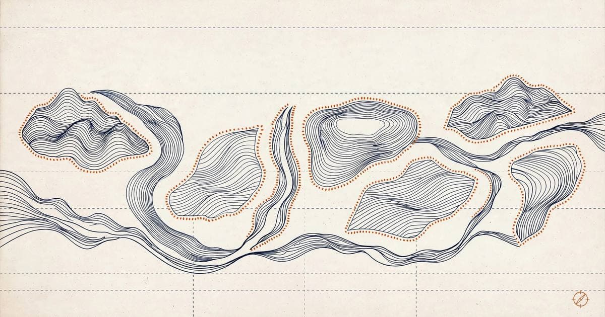
India is the only country whose map reads like a complete geography textbook: the youngest fold mountains on Earth in the north, one of the oldest plateaus in the south, a desert that was once a sea, and islands born of volcanoes and coral. Six great divisions, and the passes and straits that turned them into history. This is the physical map every UPSC map question is drawn from.
The six divisions: India's physical skeleton
India's relief falls into six major divisions. The Northern and North-Eastern Mountains (the Himalayas and the Purvanchal) wall off the north; the Northern Plains spread at their feet; the Peninsular Plateau occupies the ancient south; the Indian Desert lies west of the Aravalli; the Coastal Plains fringe both seas; and two island groups guard the Bay of Bengal and the Arabian Sea. Each division has its own rocks, rivers, soils and strategic meaning.
The geological structure of India: from Archaean to Aryan
Before the divisions, know the basement they stand on. India's rocks are grouped into four great systems, oldest first, and each carries an economic personality that prelims tests directly.
Archaean system: the oldest rocks, formed when magma solidified deep underground, so they are crystalline gneisses and schists and devoid of fossils (azoic). They form the basement complex under two-thirds of peninsular India. The Dharwar subsystem, first studied in Karnataka's Dharwad district, is metamorphosed Archaean sediment and is famously rich in iron ore, manganese, gold, copper, mica and building stone.
Purana system: ancient sedimentary deposits in two parts. The Cuddapah system (Andhra Pradesh, Chhattisgarh, Rajasthan-Delhi, the Lesser Himalayas) holds shale, slate, quartzite and low-grade iron and manganese. The Vindhyan system is the land of red sandstone and building stone, largely devoid of metallic minerals, but it hosts the diamond mines of Panna and Golconda.
Dravidian system: the Palaeozoic rock formation, laid down when much of peninsular India was under shallow seas; it is fossiliferous, unlike the systems below it.
Aryan system: the youngest, from the Upper Carboniferous onward. Its Gondwana subsystem holds nearly all of India's coal, and its Deccan Trap subsystem is the vast basalt poured out by the eruptions that accompanied the Indian plate's northward flight.
The exam logic: Archaean equals minerals, Purana equals building stone (and Panna diamonds), Aryan equals coal. One line each, and the match-the-system questions resolve.
The Himalayas: young, restless, still rising
The Himalayan arc stretches about 2,500 km from the Indus in the west to the Brahmaputra in the east, its width shrinking from roughly 400 km in Kashmir to 150 km in Arunachal Pradesh, crossing 13 states and union territories. They were born when the Indian plate rammed into the Eurasian plate, crumpling the crust into folds, and because the collision is still active, the range still rises and still shakes with frequent earthquakes.
The evidence of youth is written on the landscape: deep gorges, V-shaped valleys, rivers that take sharp U-turns (syntaxial bends), and steep gradients that trigger landslides. The mountains are a climatic wall, blocking Central Asia's cold winds and trapping the monsoon, the source of perennial rivers, and the reason the plains below are so fertile. Their orientation shifts along the arc: east-west in Darjeeling-Sikkim, southwest-northwest in Arunachal, and north-south through Nagaland, Manipur and Mizoram, where they are called the Purvanchal.
The Trans-Himalaya: beyond the great wall
North of the Greater Himalaya lie the Trans-Himalayan ranges, the Karakoram, Ladakh and Zaskar, built on the northernmost edge of the Indian plate, sometimes called the Tibet Himalaya. The Karakoram holds K2, the world's second-highest peak; the Indus threads between the Zaskar and Ladakh ranges. Passes here average over 5,300 m, with some of the highest motorable crossings on Earth.
The Greater Himalaya (Himadri): the central axis
The Himadri is the highest, most continuous range, averaging 6,000 m with a granite core and asymmetrical folds. It carries Everest (8,848.86 m), Kanchenjunga, Makalu, Dhaulagiri and Nanga Parbat, and the great glaciers, Gangotri, and Siachen, the Karakoram giant north of the Nubra valley. Its famous passes include Bara Lacha-La, Shipki-La, Nathu-La, Zoji-La and Bomdi-La. The high valleys shelter Bhotia pastoralists who migrate to bugyals, summer grasslands, and descend in winter.
The Lesser Himalaya (Himachal) and the Shiwalik
South of the Himadri runs the Lesser Himalaya, the Pir Panjal, Dhauladhar and Mahabharat ranges, rugged but lower, carrying the hill stations. Key passes of the Lesser Himalaya itself are Banihal (on the Pir Panjal, the Jammu-Srinagar highway) and Rohtang; the famous high crossings further north, Zoji La (Ladakh-Kashmir), Baralacha La (Himachal-Ladakh) and Khardung La, belong to the Greater and Trans-Himalayan ranges. The outermost Shiwalik is built of unconsolidated sediments; between it and the Lesser Himalaya lie the flat duns, Dehra Dun being the classic, fertile valleys prized for settlement.
How the range was built: three uplifts
The Himalayas were not raised in one push. A thrust fault is a near-horizontal fracture along which one slab of crust rides up over another, and the range grew as the Indian plate kept sliding beneath Asia along a staircase of such faults. The Greater Himalaya rose first, in the Eocene about 50 million years ago, when the Tethys Sea closed and the two continents met. The Lesser Himalaya followed in the Miocene, roughly 20 million years ago, pushed up along the Main Boundary Thrust. The Shiwaliks are the youngest act, folded within the last five million years out of the very debris the young rivers washed down from the rising ranges. Because the Indian plate still advances a few centimetres a year, the staircase is still moving, which is why the same belt produces earthquakes, landslides and rivers that keep sawing their gorges deeper.
Stage | When | What rose | Signature today |
|---|---|---|---|
First uplift | Eocene, about 50 million years ago | Greater Himalaya (Himadri) | Granite-cored highest peaks: Everest, Kanchenjunga |
Second uplift | Miocene, about 20 million years ago | Lesser Himalaya (Himachal) | Pir Panjal, Dhauladhar and Mahabharat ranges |
Third uplift | Pliocene to Pleistocene, last 5 million years | Shiwalik foothills | Low outermost hills of river debris, with duns behind them |
The Himalayas by river valleys: four regional divisions
Prelims also slices the range lengthwise, using the great rivers as boundary posts. The Punjab Himalaya is the stretch between the Indus and the Satluj; the Kumaun Himalaya runs from the Satluj to the Kali; the Nepal Himalaya from the Kali to the Tista; and the Assam Himalaya from the Tista to the Dihang (the Brahmaputra). Beyond the Dihang the arc bends sharply south into the Purvanchal hills of the northeast.
Division | Stretches between | Approx. length | Remember it for |
|---|---|---|---|
Punjab Himalaya | Indus and Satluj | 560 km | Kashmir and Himachal ranges; Zaskar and Pir Panjal |
Kumaun Himalaya | Satluj and Kali | 320 km | Uttarakhand; Nanda Devi and Kamet |
Nepal Himalaya | Kali and Tista | 800 km | Tallest peaks: Everest, Makalu; Kanchenjunga on the Sikkim edge |
Assam Himalaya | Tista and Dihang | 720 km | Arunachal Pradesh; Namcha Barwa at the great bend |
The Northern Plains: rivers writing on flat land
Built grain by grain from Himalayan alluvium, the Northern Plains are India's breadbasket, fertile, flat and densely peopled. They descend from the foothills in four belts. The bhabar is a narrow 8-10 km strip of coarse pebbles where rivers vanish underground. South of it the terai is marshy ground where the rivers re-emerge, forested and rich in nitrogen, Jim Corbett's grasslands stand here. Then come the bhangar terraces of older alluvium, clayey and dotted with kankar, and the khadar floodplains of newer alluvium, renewed by every flood and intensely fertile.
Belt | Where and how wide | Character that prelims tests |
|---|---|---|
Bhabar | 8 to 16 km strip at the Shiwalik foot | Coarse pebbles and boulders; streams sink and vanish; unfit for farming |
Terai | 20 to 30 km belt south of the Bhabar | Streams re-emerge; marshy, forested, wildlife-rich; now largely farmland |
Bhangar | Terraces above the flood level | Older alluvium with kankar nodules; less fertile, not flooded yearly |
Khadar | Active floodplains beside the rivers | Newer alluvium renewed by every flood; the most fertile belt |
The Peninsular Plateau: the ancient core
The peninsula is a rigid block of Gondwana rock, old, stable and mineral-rich, the geological opposite of the Himalayas. The Deccan Trap's volcanic basalts weathered into the famous black regur soil of the Maharashtra plateau, ideal for cotton. The Central Highlands, the Chotanagpur plateau (India's mineral heartland), and the ancient Aravalli, one of the world's oldest fold ranges, now worn low, complete the picture. West-flowing Narmada and Tapi run through rift valleys here, a clue to the plateau's faulted past.
Break the plateau into its blocks and the map memorises itself. A horst is a block of crust raised between two faults, and the Satpura is India's textbook horst, wedged between the Narmada and Tapi rift valleys. The Aravalli is far older, among the oldest fold mountains on Earth, now worn down to a residual ridge. Eastward, the Chotanagpur plateau carries the mineral belt, while the Meghalaya plateau is the peninsula's own block reaching into the northeast, cut off from Chotanagpur by the Malda gap, the low corridor through which the Ganga now swings toward its delta.
Block | Rock and age clue | Defining fact |
|---|---|---|
Aravalli range | Ancient fold mountains, heavily eroded | Among the oldest ranges on Earth; Gurushikhar (1,722 m) is the highest peak |
Vindhyan range | Sedimentary sandstone escarpment | Red sandstone building stone; forms the northern edge of the Narmada valley |
Satpura range | Horst between two rift valleys | Dhupgarh (1,350 m) near Pachmarhi is the highest point; Mahadeo and Maikal hills |
Chotanagpur plateau | Archaean gneiss and granite | India's mineral heartland; Parasnath (1,366 m); Damodar valley coalfields |
Meghalaya plateau | Eastward extension of the peninsula | Garo, Khasi and Jaintia hills; separated from Chotanagpur by the Malda gap |
Deccan plateau | Deccan Trap basalt lava flows | Black regur soil; slopes gently east, so its big rivers flow to the Bay of Bengal |
Western Ghats vs Eastern Ghats: the great comparison
The two great escarpments of peninsular India are a standing prelims and mains comparison. Set them side by side and the contrasts do the memorising.
Continuity and form: the Western Ghats run continuously, parallel to the west coast, for about 1,600 km through six states (Gujarat, Maharashtra, Goa, Karnataka, Kerala, Tamil Nadu); the Eastern Ghats are discontinuous, eroded and broken, stretching from the Mahanadi to the Nilgiris.
Height: the Western Ghats average about 1,500 metres and rise southward to Anamudi (2,695 m, the highest peak in peninsular India) in the Anaimalai hills and Doddabetta (2,637 m) in the Nilgiris; the Eastern Ghats average only about 600 metres, with Jindhagada (Arma Konda) in Andhra Pradesh as the highest point.
Slope and rivers: the Western Ghats present a steep escarpment to the Arabian Sea and give birth to most peninsular rivers, which then flow east and dissect the Eastern Ghats into separate hills (Nallamala, Velikonda, Mahendragiri, Javadi, Palconda ranges).
Local names: the Western Ghats are the Sahyadri in Maharashtra, the Nilgiri hills across Karnataka and Tamil Nadu, and the Anaimalai and Cardamom hills in Kerala; the two ranges meet at the Nilgiri hills.
The one-line takeaway: the Western Ghats are higher, continuous, and the water tower of the peninsula; the Eastern Ghats are lower, broken, and cut through by the rivers the west creates.
Feature | Western Ghats | Eastern Ghats |
|---|---|---|
Continuity and form | Continuous, parallel to the west coast; about 1,600 km through Gujarat, Maharashtra, Goa, Karnataka, Kerala, Tamil Nadu | Discontinuous, eroded and broken; from the Mahanadi to the Nilgiris |
Height | Average about 1,500 m; Anamudi 2,695 m (highest peak in peninsular India), Doddabetta 2,637 m | Average about 600 m; Jindhagada (Arma Konda) the highest point |
Rivers | Steep escarpment to the Arabian Sea; birthplace of most peninsular rivers | Dissected by east-flowing rivers into the Nallamala, Velikonda, Mahendragiri, Javadi and Palconda hills |
Role | The water tower of the peninsula: higher, continuous, rain-bearing | Lower and broken: cut through by the rivers the west creates |
The Indian Desert: the Thar
West of the Aravalli lies the Thar, an undulating sea of sand shaped by wind. The Luni is its signature river, ephemeral and increasingly saline, dying in the Rann of Kachchh's marshes. Wind erosion is the great degrader here; the Indira Gandhi Canal has pushed a green wedge of irrigation into the desert, proving that water, not soil, was the missing ingredient.
The desert's architecture is wind-written. A barchan is a crescent-shaped dune whose horns point downwind, the classic moving dune of the Thar. Where the wind blows steadier, dunes line up as longitudinal ridges parallel to the wind, and where sand is plentiful they stack as transverse ridges across it. Between the dunes lie rocky hamada pavements and saline flats, and the whole dune system creeps slowly eastward, which is why desertification control, shelterbelts and canal irrigation along the Thar's edge are live policy questions, not textbook ones.
The Coastal Plains: two very different edges
The western coastal plain is narrow, with estuaries on the Konkan coast and the kayal backwaters of the Malabar coast in Kerala, lagoons used for fishing, transport and tourism. Its regional faces run from the Kachchh and Kathiawar coast through Konkan, Kanara and Malabar. The eastern plain is broad and deltaic: the Northern Circars, the Utkal coast and the Coromandel coast, built by the Mahanadi, Godavari, Krishna and Kaveri deltas, and fringed by great lagoons: Chilika in Odisha, Pulicat on the Andhra-Tamil Nadu border, and Vembanad in Kerala.
Coast segment | Coast | Character |
|---|---|---|
Kachchh and Kathiawar | West (Gujarat) | Gulfs and former islands; the salt marshes of the Rann |
Konkan | West (Maharashtra, Goa) | Narrow and rocky, with estuaries and creek ports |
Kanara | West (Karnataka) | Narrow plain backed by steep Ghats; short, swift rivers |
Malabar | West (Kerala) | Kayal backwaters and lagoons; Vembanad the largest |
Utkal | East (Odisha) | Deltaic; the Chilika lagoon and the Mahanadi delta |
Northern Circars | East (Andhra Pradesh) | Godavari and Krishna deltas; the Pulicat lagoon |
Coromandel | East (Tamil Nadu) | Broad deltaic plain of the Kaveri; northeast monsoon rains |
The contrast to carry into the exam hall: the west coast is a submerged, estuarine coast, narrow (about 50 km on average) and indented, while the east coast is an emergent, deltaic coast, broad (about 100 km or more) and smooth. That single difference explains why the west holds natural harbours and the east holds deltas, and why their rivers behave so differently when they meet the sea (see geo-10).
The Islands: volcanoes and coral
The Andaman and Nicobar Islands are the tips of a submerged volcanic arc in the Bay of Bengal, Saddle Peak (738 m) in North Andaman is the highest point, and Barren Island is the only active volcano on Indian territory. The 10° Channel separates the Andamans from the Nicobars; the 6° Channel opens toward Sumatra. Lakshadweep, 200-400 km off Kerala in the Arabian Sea, is the opposite story: 36 low coral atolls and lagoons, with Kavaratti as capital and Andrott as the largest island. India's total coastline, islands included, runs 11,098.81 km.
Passes and straits: where geography becomes strategy
Himalayan passes are the doors through the wall: Shipki La (where the Sutlej enters India), Lipulekh and Mana in Uttarakhand, Nathu La and Jelep La in Sikkim, Bomdi La in Arunachal, and in the south, the Palghat, Bhorghat and Thalghat gaps that pierce the Western Ghats and carry rail and road to the coast. In the Indian Ocean, straits are the shipping lanes that matter: the Palk Strait between Tamil Nadu and Sri Lanka, the Strait of Malacca linking the Indian and Pacific Oceans, the Sunda and Lombok straits through Indonesia, the Strait of Hormuz and Bab-el-Mandeb guarding the oil routes, and the Mozambique Channel between Africa and Madagascar.
Landslides: when slopes give way
A landslide is the rapid downslope movement of rock, debris or earth under gravity, and India's two mountain systems produce them for different reasons. In the Himalayas, the causes are tectonic and climatic: young, fragile, still-rising rocks, steep slopes, intense monsoon rainfall, earthquakes, and glacial melt. In the Western Ghats, the triggers are overwhelmingly rainfall plus human pressure: heavy orographic downpours saturating the lateritic slopes, road-cutting, quarrying, construction and deforestation destabilising them.
Three mains questions have asked for the causes of and differences between Himalayan and Western Ghats landslides, and the answer structure is cause-by-cause: natural (rainfall intensity, seismicity, slope, lithology) versus anthropogenic (slope cutting for roads and buildings, mining, forest loss). Mitigation follows the same logic: drainage management, slope stabilisation and retaining structures, restricting construction on vulnerable slopes, early-warning systems, and the landslide hazard zonation maps that the Geological Survey of India now publishes.
Two recent disasters show the two mechanisms at work. In January 2023, Joshimath in Uttarakhand began to subside and crack, a slow Himalayan failure on an old landslide deposit loaded with new construction. In July 2024, cloudburst-fed landslides at Mundakkai and Chooralmala in Kerala's Wayanad district killed over 200 people on saturated lateritic slopes below the Western Ghats escarpment. Same word, landslide; different geology, different warning signs, different mitigation, which is exactly the distinction the mains question rewards.
Cross-reference: landslide-prone slopes cluster in the same belts as India's seismic zones (geo-03), because the Himalayan arc that shakes is also the arc that slides.
Key Terms
- Continuity and form: In UPSC answer writing, 'continuity and form' signals attention to both the substance that persists and the shape it takes in a new context. A question may ask how an institution survived while its form changed, such as village assemblies under different rulers. It matters because strong answers distinguish between what continued and how it was reconfigured, showing analytical depth rather than mere description.
- Slope and rivers: Slope and rivers refers to the geomorphic principle that the gradient of land controls a river's behaviour: steep slopes produce fast, erosive streams with narrow valleys, while gentle slopes produce slow, meandering rivers with depositional features like floodplains and deltas. The Himalayan and peninsular rivers of India illustrate the contrast. It matters for UPSC physical geography questions on drainage patterns, river regimes and landform formation.
- physiographic division: A physiographic division is a large region set apart by its relief, rock structure and the processes that shaped it. India has six: the Northern and North-Eastern Mountains, the Northern Plains, the Peninsular Plateau, the Indian Desert, the Coastal Plains and the Islands. The divisions are the first frame of every physical-geography answer because each one predicts its own rivers, soils, climate and hazards.
- Dravidian system: The Dravidian system is the Palaeozoic rock formation of peninsular India, laid down when much of the peninsula was under shallow seas; it is fossiliferous, unlike the rock systems below it.
- Archaean system: The Archaean system comprises the oldest rocks of the Earth's crust, older than 2.5 billion years, known in India as the Purana or fundamental gneisses. Made of heavily metamorphosed gneiss, schist and granite, these azoic rocks (without fossils) form the basement of peninsular India in the Aravallis, Bundelkhand and the Chotanagpur plateau. UPSC geography treats them as India's oldest geological formation and a major source of metallic minerals like iron, gold and mica. The Bundelkhand gneiss of Uttar Pradesh and Madhya Pradesh.
- syntaxial bend: A syntaxial bend is the sharp hairpin turn a mountain arc makes at its ends, where the range swings direction. The Himalayas bend at the Nanga Parbat syntaxis in the west and the Namcha Barwa syntaxis in the east, and antecedent rivers like the Indus and Brahmaputra cut their deepest gorges exactly there. UPSC uses the bends to test whether students can read the arc as one collision structure rather than a list of ranges.
- Eastern Ghats: The Eastern Ghats are the discontinuous ranges of hills running along India's eastern coast from Odisha through Andhra Pradesh to Tamil Nadu. Older and lower than the Western Ghats, they are cut through by the Mahanadi, Godavari, Krishna and Kaveri, which reach the Bay of Bengal through their gaps. For UPSC, they are essential physical geography, often contrasted with the Western Ghats on continuity, height and rainfall.
- Purana system: The Purana system is one of India's rock systems: ancient sedimentary deposits laid down in two parts, the Cuddapah system (Andhra Pradesh, Chhattisgarh) and the Vindhyan system, the land of red sandstone and building stone, largely devoid of metallic minerals but hosting the diamond mines of Panna and Golconda.
- Western Ghats: The Western Ghats are the 1,600-km mountain chain running parallel to India's west coast from Gujarat to Tamil Nadu. Older than the Himalayas, they intercept the southwest monsoon to shape the west coast's heavy rainfall and the Deccan's rain shadow, host exceptional endemic biodiversity, and feed peninsular rivers like the Godavari and Kaveri. For UPSC, they are a recurring geography and environment topic. Their inscription as a UNESCO World Heritage Site in 2012 across 39 serial sites, recognising one of the world's eight hottest biodiversity hotspots.
- Aryan system: The Aryan system is the youngest of India's rock systems, running from the Upper Carboniferous onward. Its Gondwana subsystem holds nearly all of India's coal reserves.
- Local names: Local names is a geography-study shorthand for the regional terms given to winds, soils, rivers and landforms across India and the world. Such terms appear frequently as one-mark prelims questions because UPSC tests whether aspirants know the Indian name for a physical feature beyond its textbook label. Absolute location and regional vocabulary together decide many map-based answers. For UPSC, memorising standard local-name tables is a quick-scoring prelims tactic for physical geography.
- Himalayas: The Himalayas are the world's highest and youngest fold mountain system, formed by the collision of the Indian and Eurasian tectonic plates that began around 50 million years ago. Their three parallel ranges, the Himadri, Himachal and Shiwalik, act as India's climatic barrier, the source of its great rivers, and a biodiversity hotspot. For UPSC they underpin questions on physiography, monsoon, disasters, and border and environmental issues. Mount Everest (8,848.86 m), on the Nepal-Tibet border, is the highest peak of the Himalayas.
Practice questions
Consider the following statements about the Himalayas:
1. They extend from the Indus river in the west to the Brahmaputra river in the east, covering about 2,500 km.
2. Their width varies from about 400 km in Kashmir to about 150 km in Arunachal Pradesh.
3. They were formed by the collision of the Indian and Eurasian plates, which is still active today.
Show answer
Answer: (D) Extent, width variation and plate-collision origin are all correctly stated.
Consider the following statements:
1. K2, the second-highest peak in the world, lies in the Karakoram range.
2. The Indus river flows between the Zaskar and Ladakh ranges.
3. The Pir Panjal range is part of the Greater Himalaya.
Show answer
Answer: (A) Statement 3 is wrong, the Pir Panjal belongs to the Lesser Himalaya, not the Greater.
Consider the following statements about the Northern Plains:
1. In the bhabar belt, rivers disappear underground due to high permeability.
2. Bhangar is newer alluvium and more fertile than khadar.
3. Khadar consists of newer alluvium deposited annually and is extremely fertile.
Show answer
Answer: (A) Statement 2 is reversed, bhangar is the older, less fertile alluvium; khadar is the newer.
Consider the following statements about India's islands:
1. Barren Island is the only active volcano located in Indian territory.
2. Saddle Peak (738 m) in North Andaman is the highest peak of the Andaman and Nicobar Islands.
3. The 6° Channel separates the Andaman Islands from the Nicobar Islands.
Show answer
Answer: (A) Statement 3 is wrong, the Andaman-Nicobar split is the 10° Channel; the 6° Channel faces Sumatra.
Consider the following statements:
1. The Palk Strait separates the Tamil Nadu coast of India from northern Sri Lanka.
2. The Strait of Malacca links the Indian Ocean with the Pacific Ocean and is among the busiest shipping lanes in the world.
Show answer
Answer: (C) Both statements about the Palk Strait and the Strait of Malacca are correct.
Answer key
- (d): Extent, width variation and plate-collision origin are all correctly stated.
- (a): Statement 3 is wrong, the Pir Panjal belongs to the Lesser Himalaya, not the Greater.
- (a): Statement 2 is reversed, bhangar is the older, less fertile alluvium; khadar is the newer.
- (a): Statement 3 is wrong, the Andaman-Nicobar split is the 10° Channel; the 6° Channel faces Sumatra.
- (c): Both statements about the Palk Strait and the Strait of Malacca are correct.
Mains Practice question
Q. Differentiate the causes of landslides in the Himalayan region and Western Ghats. (UPSC 2021, 150 words)
Framing hintBuild a two-column comparison. For the Himalayas, stress tectonic youth, active collision, steep gradients, fragile sedimentary rocks, deep gorges, plus triggers: cloudbursts, deforestation, road-cutting and hydropower tunnelling. For the Western Ghats, stress an old, stable escarpment where landslides come from intense monsoon saturation of laterite slopes, quarrying and construction on steep gradients. Draw a small cross-section of each slope type showing the failure plane. Close with mitigation: early-warning systems, slope-stabilisation, regulated construction and watershed treatment, differentiating what works where.
Asked in the mains
Previous-year questions from this topic
How UPSC has actually asked this topic — with the year and marks for each question.
- 202110 marks
Why is India considered as a subcontinent? Elaborate your answer. ?
- 201915 marks
How can the mountain ecosystem be restored from the negative impact of development initiatives and tourism?
- 201512.5 marks
The states of Jammu and Kashmir, Himachal Pradesh and Uttarakhand reaching the limits of their ecological carrying capacity due to tourism. Critically evaluate.
- 202110 marks
Differentiate the causes of landslides in the Himalayan region and Western Ghats.
- 201612.5 marks
The Himalayas are highly prone to landslides. Discuss the causes and suggest suitable measures of mitigation.
- 20135 marks
Bring out the causes for more frequent landslides in the Himalayas than in Western Ghats
Asked in the prelims
Previous-year MCQs from this topic
How UPSC has tested this topic in the prelims — pick an option to test yourself.
- 2023Prelims
1.Consider the following statements: 1. Amarkantak Hills are at the confluence of Vindhya and Sahyadri Ranges. 2. Biligirirangan Hills constitute the easternmost part of Satpura Range. 3. Seshachalam Hills constitute the southernmost part of Western Ghats How many of the statements given above are correct?
- 2022Prelims
2.Consider the following pairs : Peak Mountains 1. Namcha Barwa — Garhwal Himalaya 2. Nanda Devi — Kumaon Himalaya 3. Nokrek — Sikkim Himalaya Which of the pairs given above is/are correctly matched ?
- 2020Prelims
3.Siachen Glacier is situated to the
- 2017Prelims
4.Consider the following statements: 1. In India, the Himalayas are spread over five States only. 2. Western Ghats are spread over five States only. 3. Pulicat Lake is spread over two States only. Which of the statements given above is/ are correct ?
- 2014Prelims
5.Consider the following pairs : Hills Region 1. Cardamom Hills : Coromandel Coast 2. Kaimur Hills : Konkan Coast 3. Mahadeo Hills : Central India 4. Mikir Hills : North-East India Which of the pairs are correctly matched?
- 2012Prelims
6.When you travel in Himalayas, you will see the following: 1. Deep gorges 2. U-turn river courses 3. Parallel mountain ranges 4. Steep gradients causing land sliding Which of the above can be said to be the evidence for Himalayas being young fold mountains?
- 2010Prelims
7.If there were no Himalayan ranges, what would have been the most likely geographical impact on India ? 1. Much of the country would experience the cold waves from Siberia. 2. Indo-gangetic plain would be devoid of such extensive alluvial soils. 3. The pattern of monsoon would be different from what it is at present. Which of the statements given above is/are correct ?
- 2008Prelims
8.Which of the following hills are found where the Eastern Ghats and the Western Ghats meet?